Mapping Technology for Real Estate
Technology to help you show off the location of your property
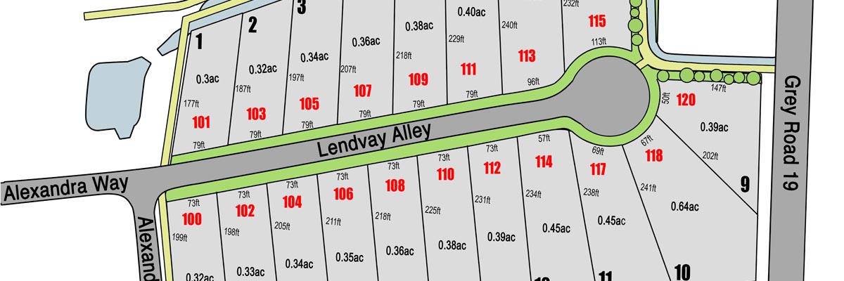
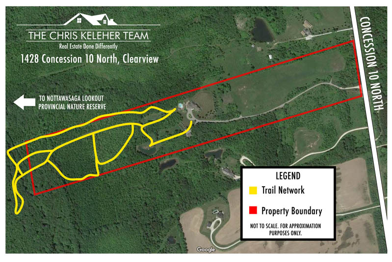
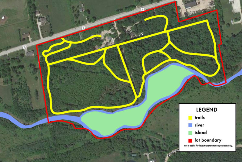
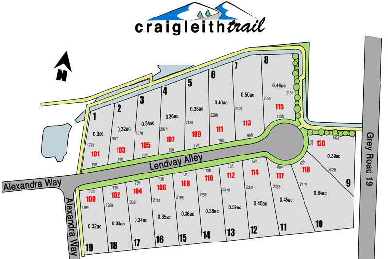
About Mapping and Site Plan Illustrations
When you have properties with amazing nearby features, locations, or even just a whole lot of property, utilizing maps and custom illustrations can help showcase what you want your visitors to see. We build every map completely custom to your property's needs, and have often been used to showcase; river, creeks and water bodies, property boundaries, hiking and snowmobile trails, nearby roadways, structures and outbuildings, and more.
Where can I use a custom map?
Custom made maps can be included anywhere you'd regularly use a photo, from your MLS listing online, to your social media posts, and in printed brochures and other visual advertising mediums.
Costing for Maps
The time needed for building maps can vary based upon the property, and the detail to be included as well as the scale or scope the map is to cover. We charge our regular graphic design rate hourly for map designs. Most maps can be built in less than two hours.
Examples